Author: Tim Antill
General area: Northern Rockies, Hart Range
Trip start date: 2024-09-05
Number of nights: 2
At 2,500 m and its distinctive pyramidal shape, Sentinel Peak is one of the more distinctive mountains in the Hart Range. On a clear day it can be seen from vantage points in PG, or from the slopes of Powder King. I remember flying over the area for work back in 2010 and seeing its snowcapped peak standing out among all the other mountains. At the time I thought it would be a great mountain to climb one day. Fast forward 14 years, a number of reconnaissance missions, failed attempts, and hours of google earth time on long winter nights… success at last.
The morning of September 5th, 2024, Andrea Robertson, Gretchen Prystawik, Radim Suchanec, and myself were feeling pretty confident we would finally summit Sentinel Peak. We had a good route that we refined from a summer 2023 trip; we had a good weather window; and a good crew with a keen sense of adventure and humour. Key ingredients for any great trip.
Our route accesses the area using a cutblock road off of the Crocker FSR to get near Mt Bracey; unfortunately, the road was recently deactivated adding an additional 5 kms to our trip. As luck would have it, we had learned of the deactivation a few weeks in advance and brought mountain bikes. The ride to the former trailhead was not too bad, with some hike-a-bike sections through the more aggressive deactivations. Still much better than walking. For some of us, the water bar pump track was even fun in places.
This route is full of ups and downs…. literally. For those familiar with the area, the forests are a jungle of devils club, alder, rhododendron, and blowdown. Our approach was to stay high, use ridgelines, and for our sanity keep the bushwhacking to an absolute minimum. This meant hikes up to the alpine, dropping into valleys, and climbing back up to alpine again. Day 1 was ~16km and consisted of 1421m of climbing.
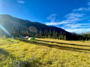
At the end of Day 1 we found ourselves in a beautiful hidden valley with open meadows near the base of Sentinel. The huckleberries were plump, plentiful, and delicious. As we ate dinner watching the sunset on the peak, we had a friendly wager on what time we would summit the next day. It is good to have optimistic friends… but we were all a little ambitious with our predictions. We also had a lively debate over the merits of camper vans vs truck and campers. For the record, votes are 3 to 1 for the van option. #VanLife
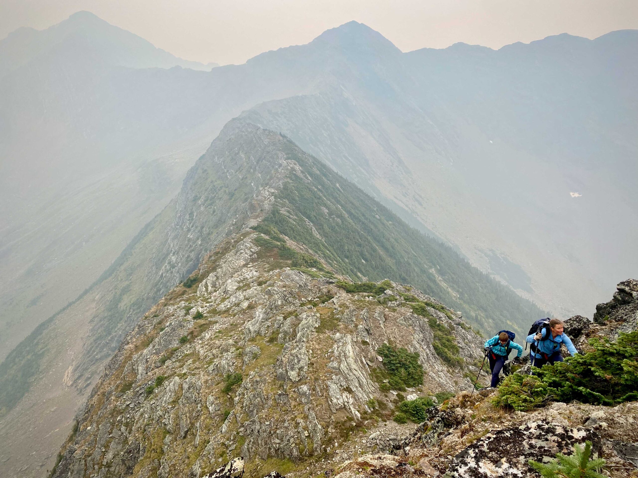
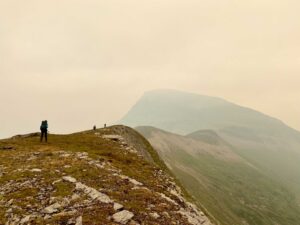
Our alarms were set for an early departure at first light. To our complete surprise, when we popped our heads out from our tents in the morning, the air was thick and acrid with the smell of smoke, and ash danced in the beam of our headlamps. What the…?!? We had not expected thick wildfire smoke would roll in and obscure hopes of seeing anything from the summit. Not to be deterred, we started off anyways.
From our base camp, we hiked up to a pass to the next valley and then followed a ridge to the base of what Google Earth calls Sentinel S4. This pass, as well as others along the route that offer the path of least resistance are grizzly bear superhighways. Bear tracks from generations of use have formed well-worn paths consisting of a series of footprints where they step in the same place each time. We did not see any grizzlies on this trip, but have in the past, and there was no shortage of fresh sign to remind us that we were visiting their backyard.
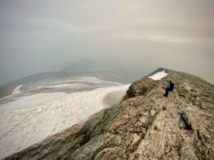
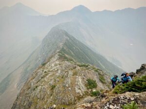
We sucked in smoke as we made our way up to the summit. There were some pitches that looked like they would be a little tricky from a distance, but turned out to be easily manageable once up close. One cool surprise for us was finding a glacier on the backside of Sentinel. The Google Earth imagery is from winter and I had never noticed it before. We made it to the summit at 1:15pm. To celebrate there was a round of high fives and a sip of Czech plum brandy. As expected, the smoke was too thick and we could not take in much of the surrounding views.
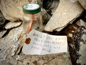
We had heard rumours of a party summiting Sentinel in the 80s from Tumbler Ridge rail line/Table River side. At the summit there was a rock cairn with a note from Thea and Dieter Koppe from April 5th, 1980. There is a good PGBRS trip report from Joel McLay on a winter route/summit in 2016. We knew we would not be the first to the top of Sentinel, but could be pleased to know we would be among a pretty short list. As far as we know, we are the first to use a summer route from the Anzac side.
Thirteen hours later we rolled back into camp thirsty and tired. It was 19.2 km round trip and 2,024m of climbing. Water was very scarce along the way and there was only one place where a little seepage between some rocks was found, but we expected that would be the case.
Day 3 we packed up and started heading back out. There is a small alpine lake off the backside of Mt Bracey that would make a nice camp spot if someone wanted to break up the trip out. The smoke was rolling in again and we decided we would just head for home. The worst part of the trip was the bushwhacking off of Mt Bracey to the old logging road in the valley below. We had deviated slightly from our route up and the blowdown and thick brush seemed particularly egregious on our weary souls. Fortunately, Gretchen’s real fruit candies saved the day and restored our spirits and sugar levels. Then it was back to the bikes and mostly downhill to the waiting truck.
On the drive out we tried to rate this hike. I don’t think we came to a conclusion. We are all very happy we finally made it up Sentinel. Would we do it again…? Undecided. It is still too fresh. It is a tough long hike, and there are plenty of other tough long hikes yet to do. Of course give it some time for the hard parts to be purged from our collective memories, and we will stumble across the photos from the trip next winter and think, “man that was a good time, we should go back for the views”.
